navneetdalal.com – Before becoming the first President of the United States and a prominent military leader, George Washington had an early career as a land surveyor. This lesser-known chapter of his life played a crucial role in shaping his character, skills, and understanding of the land, which would serve him well during his later roles as Commander-in-Chief of the Continental Army and as the founding leader of a new nation. Washington’s work as a land surveyor not only helped him acquire land and financial independence but also provided him with invaluable knowledge of the geography and challenges of the American frontier. His experiences as a surveyor shaped his leadership abilities and gave him insights into land management, geography, and the significance of westward expansion.
The Beginning of Washington’s Career in Surveying
George Washington’s interest in surveying began at a young age. Born in 1732 in Westmoreland County, Virginia, he was the son of Augustine Washington, a successful planter and landowner. Although Washington did not receive a formal education beyond basic schooling, he was encouraged to develop practical skills that would benefit him in his adult life. One of these skills was surveying, which was a highly practical and valuable profession in colonial Virginia, where land acquisition and expansion were central to the economy.
At the age of 15, George Washington was introduced to surveying by a relative, Lawrence Washington, who was a well-established figure in Virginia. Lawrence recognized George’s interest in the field and gave him a primer on surveying techniques. Washington quickly became proficient in the practice, demonstrating an aptitude for reading maps, calculating distances, and traversing rugged terrain. His early work as a surveyor was both a practical skill and an opportunity to build connections with influential figures in the Virginia colony.
Washington’s First Surveying Expedition
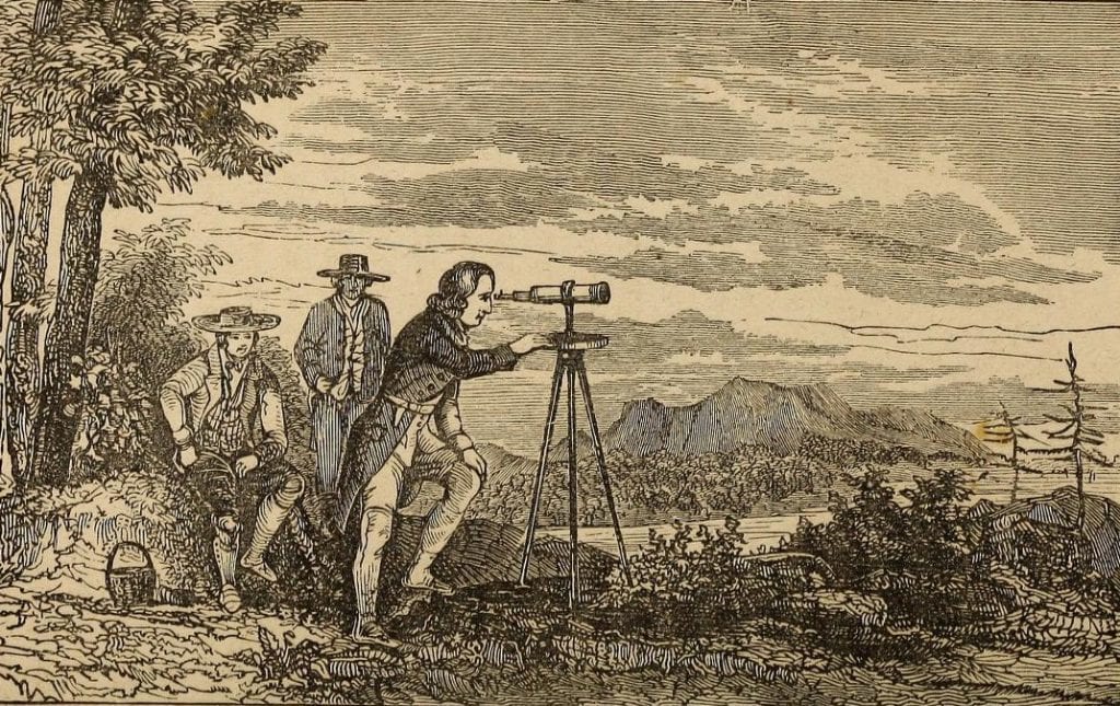
Washington’s first significant experience as a surveyor came in 1749 when he was 17 years old. At the time, he was appointed as an official surveyor for Culpeper County, Virginia, by the Virginia Governor, Robert Dinwiddie. This appointment was a significant milestone for Washington, and it marked the beginning of his surveying career. His first assignment was to survey land in the western part of the colony, in the frontier region of the Blue Ridge Mountains. This area was largely unsettled and rugged, and Washington’s job was to help map the land and create accurate records of the boundaries for settlers.
During this early survey, Washington worked in the wilderness, traversing difficult terrain, mapping land, and using rudimentary tools to mark boundaries and establish land claims. The job was physically demanding, requiring Washington to spend long hours outdoors, navigating dense forests, mountains, and swamps. Despite the challenges, Washington’s work as a surveyor was precise and diligent, earning him respect from his contemporaries.
The Significance of Surveying in Colonial America
In colonial Virginia, land surveying was a key profession because the colony’s economy was primarily agrarian, and land ownership was a significant social and economic determinant. The ownership and cultivation of land were central to the colony’s agricultural system, particularly tobacco farming, which required large tracts of fertile land. The value of land in colonial Virginia was immense, and determining property boundaries through surveying was essential to avoid disputes and ensure clear land titles. Surveyors, like Washington, played a crucial role in facilitating the growth and development of colonial Virginia by mapping and measuring land for settlement and expansion.
Surveying was also important in the broader context of the British Empire’s colonization of North America. The British government and colonial authorities needed accurate maps to better understand the land, its resources, and its potential for expansion. As a surveyor, Washington became involved in the larger narrative of westward expansion, particularly as tensions grew between the British and French over territorial control in the Ohio Valley region.
Washington’s Role in Mapping the Frontier
Washington’s early surveying work gave him a unique understanding of the vast and largely unexplored lands to the west of Virginia. His surveys in the western part of the colony provided him with invaluable experience in navigating the difficult terrain and dense forests of the Appalachian Mountains, areas that would later become critical during his military career.
His surveying skills would prove essential when, in the mid-1750s, tensions between the British and French led to the outbreak of the French and Indian War. Washington’s knowledge of the frontier, gained from his surveying expeditions, made him an ideal candidate for military leadership in the conflict. His early exposure to the geography and landscape of the contested regions, including the Ohio Valley, would play a significant role in his future as a military commander.
Washington’s work in the frontier also introduced him to the realities of settlement, land disputes, and the interactions between colonial settlers and Native American groups. These experiences deepened his understanding of the complexities of frontier life and the challenges of maintaining control over contested territories. He would later apply this knowledge in his military campaigns during the French and Indian War and the American Revolution.
Surveying and Washington’s Personal Life
As a young man, Washington’s surveying work allowed him to gain independence and financial security. Through his surveys, he earned wages and fees for his services, which provided him with the funds necessary to expand his own land holdings. The land he acquired through his surveying work would later become central to his personal wealth and status. Over time, Washington accumulated substantial land holdings, particularly in the western parts of Virginia, which he viewed as vital for his future prosperity.
In addition to his surveying work, Washington used the connections he made through his profession to build relationships with prominent figures in Virginia, including landowners, politicians, and military leaders. These relationships would prove beneficial later in life, as they helped him secure support and resources for his military and political endeavors.
One of the most important outcomes of Washington’s surveying career was his acquisition of Mount Vernon, the estate that would become his home and a symbol of his legacy. Through his work as a surveyor and his investments in land, Washington was able to acquire the property in 1754, following the death of his half-brother, Lawrence Washington, who had originally owned the land. Mount Vernon became the center of Washington’s life, serving as both a personal refuge and a model of agricultural and land management.
Washington’s Surveying Legacy
Although George Washington is primarily remembered for his role as the first President of the United States and the leader of the Continental Army, his early career as a land surveyor played an important role in shaping his character and leadership abilities. His work as a surveyor not only provided him with practical skills but also taught him how to navigate difficult terrain, solve complex problems, and work with others to accomplish goals. These skills were crucial in his military and political career.
Moreover, Washington’s surveying work helped him understand the land, the economy, and the growing frontier of the American colonies. His intimate knowledge of the geography of Virginia and the frontier regions would serve him well when he took on leadership roles during the French and Indian War and later in the American Revolution. His ability to survey land, understand its strategic value, and manage resources became a key asset as he directed military campaigns and led the fledgling nation to independence.
Washington’s legacy as a surveyor is also reflected in the meticulous records he kept throughout his surveying career. Many of his maps, reports, and records are preserved today, providing historians with insight into his work and the development of the American frontier. These documents offer a window into the challenges and opportunities that Washington faced as he mapped the land and helped expand the borders of colonial America.
Conclusion: The Impact of Washington’s Work as a Land Surveyor
George Washington’s early career as a land surveyor may seem like a humble beginning for the future first President of the United States, but it was, in fact, a formative chapter in his life. His surveying work taught him practical skills, such as land management and navigation, which would prove invaluable in his military and political leadership. Washington’s deep understanding of the land, combined with the relationships he built through surveying, shaped his later decisions as a military commander and statesman.
Moreover, Washington’s surveying career allowed him to accumulate the land and wealth necessary to become a prominent figure in Virginia’s social and political circles. The estate of Mount Vernon, which he acquired through his work as a surveyor, would become one of the most iconic symbols of his life and legacy.
In the broader context of American history, Washington’s early work as a surveyor also contributed to the westward expansion of the United States and the mapping of the American frontier. His role in surveying the land and establishing boundaries helped pave the way for future generations of settlers and explorers.
Today, George Washington’s legacy as a land surveyor is a reminder of the importance of practical skills, perseverance, and a deep understanding of the land in shaping the history of the United States. Through his surveying work, Washington laid the groundwork for his later achievements and demonstrated the critical role that knowledge of the land played in the founding of the nation.